


Software for camera traps
Over the last 20 years, camera traps have revolutionised wildlife ecology and conservation. Although advances in digital technology have increased capacity while lowering prices, the increasing number of camera-trap surveys is resulting in overwhelming amounts of data. In the last few years, efforts have thus increasingly focused on data management, analysis and interpretation to support monitoring efforts and conservation outcomes.
Camera trap analysis package (CTAP)
ZSL has developed a camera-trap package for managing and processing large volumes of image data efficiently and reliably, translating this information into standardised outputs for monitoring the status of wildlife species and communities and the threats impacting them.
The system can help form the basis for effective long-term wildlife monitoring of conservation areas. It will allow conservation organisations to evaluate quickly and reliably the impact of law enforcement and other management interventions.
It also has the potential to provide much needed data to feed into national biodiversity strategy and action plans (NBSAPs) and to contribute to regional and global CBD indicators such as the Living Planet Index and Red List Index.


CTAP features
The current version of the package has the following key features:
- Image metadata processing tool
- Configurable data model with standardised country species templates
- Image filtering and editing
- Exporting of tables, charts and maps in Excel, Word, csv, and xml formats
- Survey effort reports
- Human activity module
- Species outputs:
- Species list (taxonomically ordered with information on habitat, habit, tropic level, adult body weight, average home range, IUCN Red List threat status)
- Species detections by camera stations
- Date/time of detections by species
- Multi-species spatio-temporal plots
- Rarefaction curves and species richness estimates
- Trapping rates (overall and daily)
- Occupancy modelling with site covariates
- Activity plots (radial and bar plots)
- Distribution maps on camera-trap grids in Google Earth, QGIS and ArcGIS
The package is being used at ZSL to centrally manage and process survey data and generate standardised reports for conservation management. ZSL has been helping with systematic camera-trap surveys across a range of sites and habitats including desert systems (Saudi Arabia, Mongolia, Niger, Chad), grassland systems (India, Nepal, South Africa) and forest systems (Kenya, Cameroon, Liberia, Guinea, Thailand, Indonesia, Russia). We have developed extensive training materials, standardised protocols, and field training courses in camera-trap survey design, field set-up, data management and analysis.
The following features are being considered for the next major update of the package: i) Individual ID animal module; ii) data outputs for population density estimates for marked animals (spatially explicit capture-recapture modelling); iii) activity level modelling; iv) diversity measures; v) species community structure plots; vi) statistical tests (chi-square, circular statistics etc.); vii) cross survey analyses; viii) standardised reports generation in Word and RTF; and ix) feature for generating distance data for population density estimates for unmarked animals in the cataloguer tool.
CTAP Update files (download)
CTAP Demo database (download)
CTAP User guides and data import template (download)
Country species lists (download)
Please check back for future updates to the software.
Further reading: R. Amin & T. Wacher (2017). A new comprehensive package for the management and analysis of camera trap data for monitoring antelopes and other wild species. Gnusletter Vol 34 (2): 21-23. Available here.
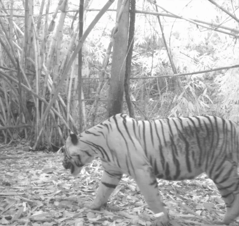
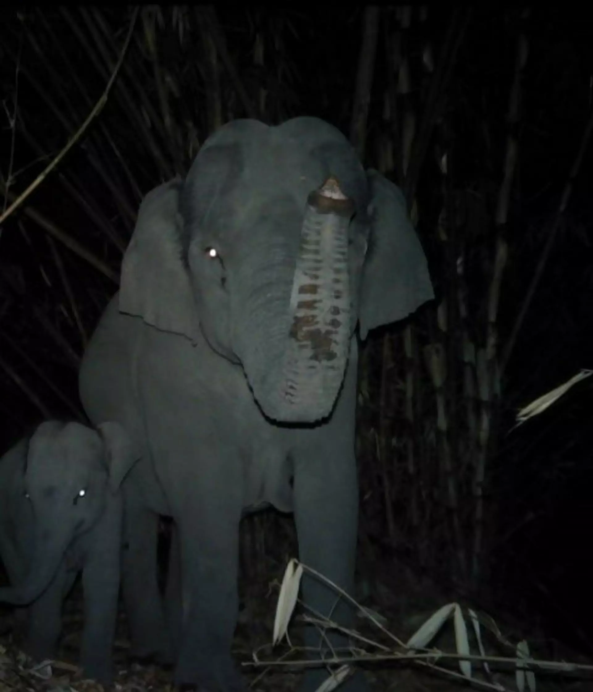
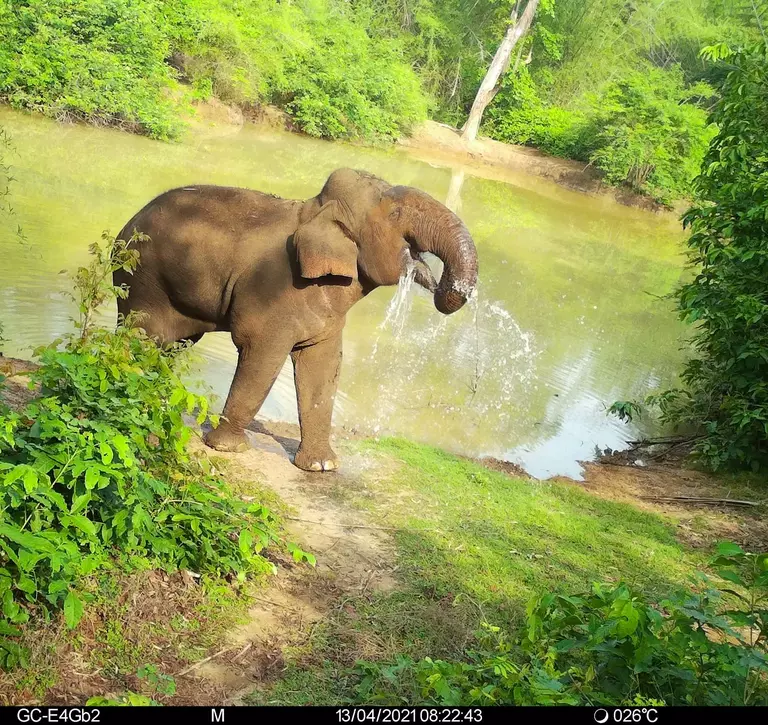
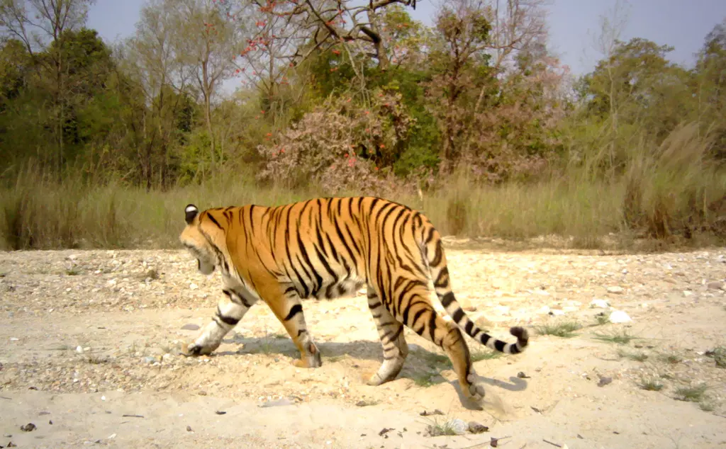
CTAP in action
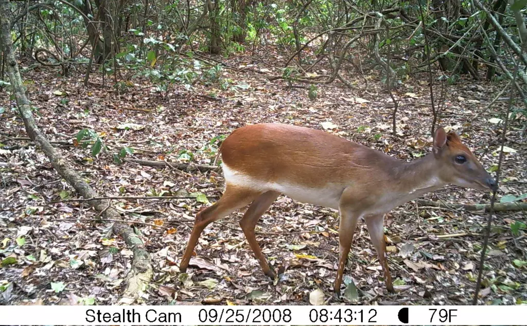
Mammal diversity survey in the northern coastal forests of Kenya
We undertook seven camera trap surveys in the forests of the northern coast of Kenya, in two different key areas: the Arabuko-Sokoke Forest, and in and around the more northern Boni-Dodori forest system. These sites are all representative of the Coastal Forests of Eastern Africa biodiversity hotspot. The main study objective was to establish baseline data on the medium-to-large sized mammal communities of the northern group of forests as part of developing a longer term conservation and management plan for the area. Four surveys were carried out in 2010, and three surveys carried out in 2015.
The more northern coastal forests (Boni-Dodori region) recorded higher terrestrial mammal species richness than Arabuko-Sokoke Forest. The majority of medium-to-large mammal species were recorded much more frequently in the Boni-Dodori forest system. The Boni-Dodori forest system also emerges as the global centre for the Critically Endangered Aders’ duiker (Cephalophus adersi).
Other species such as the lesser kudu (Tragelaphus imberbis) were recorded only in the dry coastal scrub habitats of northern coastal forests highlighting the additional importance of preserving the wider inter-connected mosaic of habitats representing complete communities of herbivores and predators in the coastal habitats.
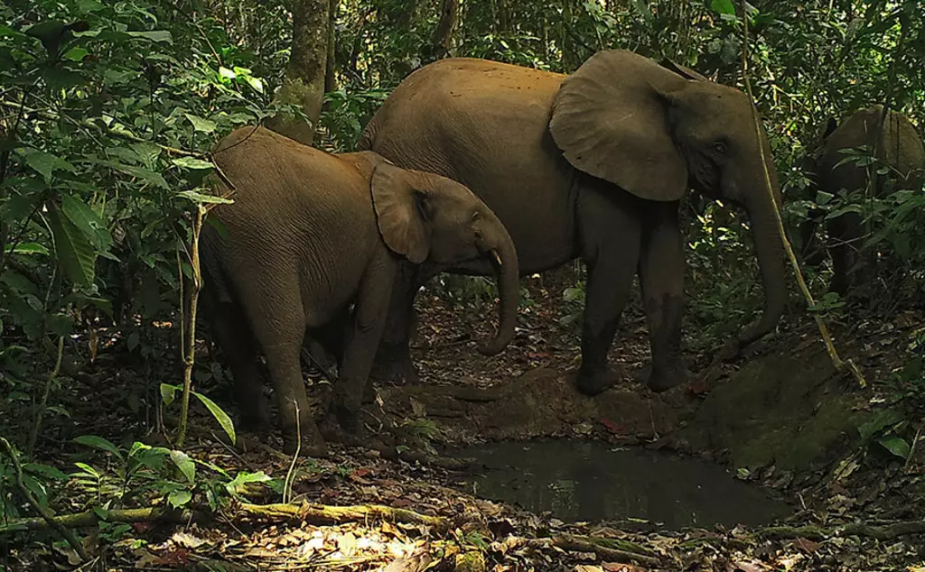
Camera trap surveys in the Dja Biosphere Reserve, Cameroon
The Cameroon Ministry of Forest and Fauna (MINFOF) in partnership with ZSL carried out an extensive baseline survey of medium-to-large terrestrial mammals within the Dja over the period 2016-2020. Eight camera-trap grids (305 camera-trap sampling points) were deployed across the Reserve with a total survey effort of 28,277 camera-trap days.
A total of 34 medium-to-large terrestrial mammal species were photographed in the camera-trap surveys. A further seven medium-to-large arboreal mammals were documented, although they were not the target of the surveys. The species accumulation curves for medium-to-large terrestrial mammals show more species detected per unit effort in the south than the north. Among other results, the survey documented the first record of the occurrence of the mandrill (Mandrillus sphinx) in the Reserve, east of the Dja River, which represents the northernmost extent of their range.
For more information on these studies, see the reports listed below.
Further reading
Examples of recent reports created using CTAP
1. Stokes, H. et al. 2016. Mammal diversity survey in the northern coastal forests of Kenya [Download]
2. Wacher, T. et al. 2016. Mammal diversity survey in the Ibex Reserve, Saudi Arabia [Download]
3. Bruce, T. et al. 2017. Camera-trap survey for larger terrestrial wildlife in the Dja Biosphere Reserve, Cameroon [Download]
4. Wacher, T. et al. 2019. Mammal diversity survey, Uruq Bani Ma’arid Protected Area, Saudi Arabia [Download]
5. Amin, R. et al. 2019. Camera Trap Survey in Sapo National Park, Liberia [Download]
6. Amin, R. et al. 2023. The conservation value of Dja Faunal Reserve for tropical forest mammal communities [Download]
Examples of peer-reviewed publications using the package
Amin, R. et al. (2023). Giant pangolin and white-bellied pangolin observations from a World Heritage site. Mammalia DOI: 10.1515/mammalia-2021-0173
Amin, R. et al. (2022) Status and ecology of forest ungulates in the Dja Faunal Reserve, Cameroon. Mammalia DOI: 10.1515/mammalia-2021-0175
Amin, R. et al. (2022) Medium-to-large mammal diversity and status of forest antelopes in the Sapo National Park, Liberia. African Journal of Ecology DOI:10.1111/aje.12990
Amin, R. et al. (2021) Habitat use of the endangered golden-rumped sengi Rhynchocyon chrysopygus. African Journal of Ecology DOI: 10.1111/aje.12804
Amin, R. et al. (2021) The status and ecology of the sand cat in the Uruq Bani Ma’arid Protected Area, Empty Quarter of Saudi Arabia. Mammalia. DOI 10.1515/mammalia-2020-0031
Amin, R. et al. (2019) Abundance, distribution, habitat, activity and conservation of Sokoke bushy-tailed mongoose Bdeogale omnivora in central and north coast forests of Kenya. Journal of East African Natural History DOI 10.2982/028.108.0103
Bruce, T. et al. (2018) Using camera trap data to characterise terrestrial larger‐bodied mammal communities in different management sectors of the Dja Faunal Reserve, Cameroon. African Journal of Ecology DOI: 10.1111/aje.12574
Amin, R. et al. (2018) Africa’s forgotten forests: the conservation value of Kenya’s northern coastal forests for large mammals. Journal of East African Natural History 107(2): 41–61.
Amin, R. et al. (2017) Sympatry among three suid species (family Suidae) on the north coast of Kenya. Journal of East African Natural History 106(2): 67–78.
Amin, R. et al. (2016). Status and behavioural ecology of sengis in the Boni-Dodori and Arabuko-Sokoke forests, Kenya, determined by camera traps. Journal of East African Natural History 105(2): 223–235.
Amin, R. et al. (2015). The northern coastal forests of Kenya are nationally and globally important for the conservation of Aders’ duiker Cephalophus adersi and other antelope species. Biodiversity and Conservation DOI 10.1007/s10531-014-0842-z