


Members of the public can dive into the past as our conservationists launch an interactive map bringing to life the history of Critically Endangered ‘dinosaur’ fish – as part of urgent work to protect the remaining few.
Launching today, the Sturgeon in the UK map allows users to step back in time and explore over 2,500 historical records of sturgeon in the UK in a bid to boost conservation efforts for the species.
Mapping 400 years of sturgeon history
Created by ZSL, which coordinates the UK Sturgeon Alliance, the map created in partnership with Natural England highlights historic hotspots for focusing modern conservation action, while also providing the public and policy makers the opportunity to explore over 400 years of sightings of this forgotten part of UK wildlife.
Hannah McCormick, ZSL’s Conservation Project Officer for Estuaries and Wetlands, who led the map’s creation, explained: “Although they were once found in almost every river across the UK, sturgeon are now sadly missing from our waters and coastlines. Our work to make the UK a safe home for sturgeon once more relies on public and government support, so alongside developing a solid, evidence-based approach to recover sturgeon, we’re launching this map to celebrate their history and inspire everyone to learn about these impressive animals.”

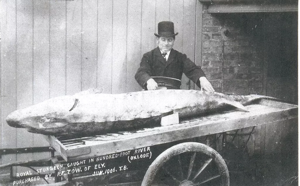

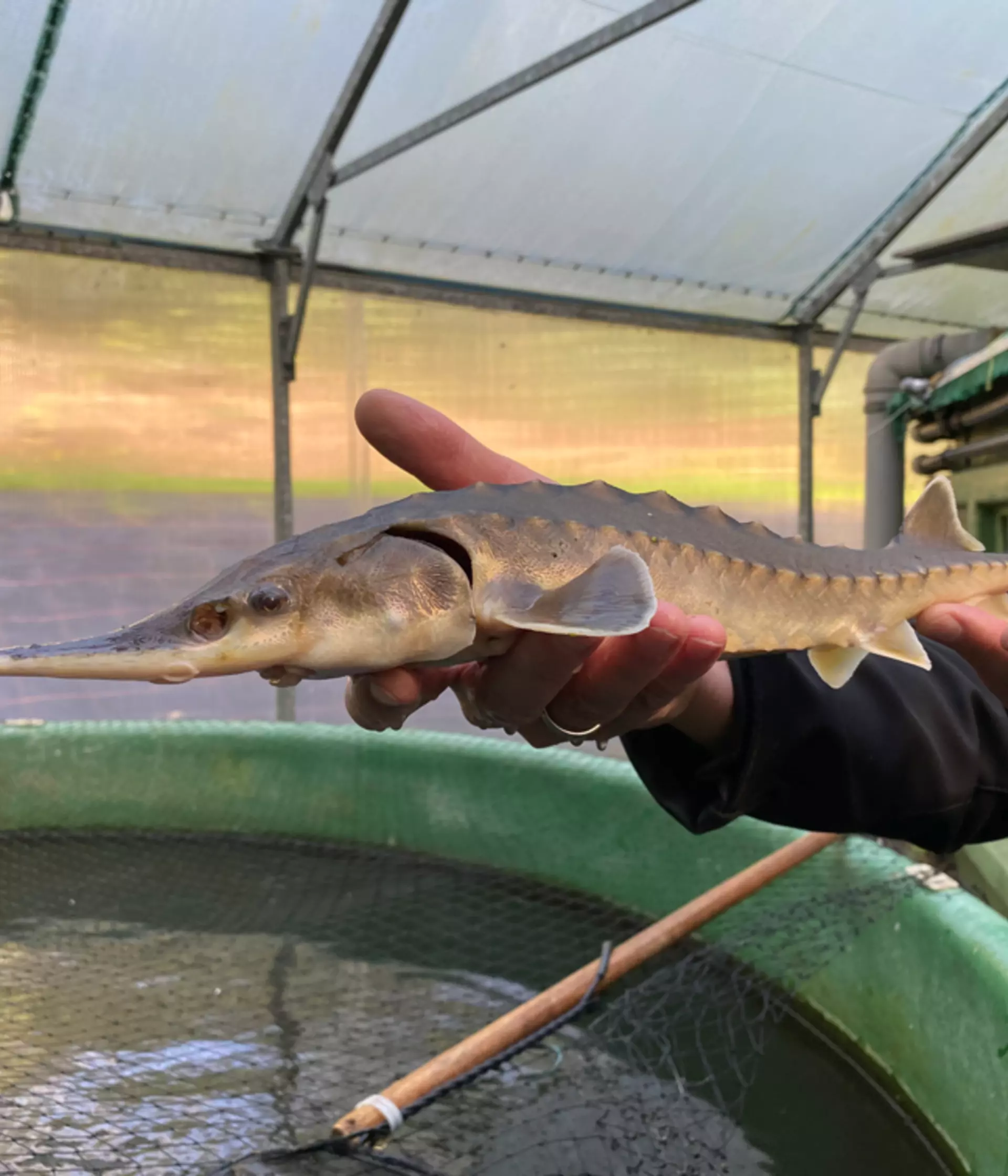
“Growing up to 5m in length, these ancient fish are truly something to behold. They were around at the time of the dinosaurs and with their armoured plates and whisker-like barbels, they still closely resemble these ancient relatives from 100 million years ago. They were even declared ‘royal fish’ by King Edward II in the 14th century – sparking a tradition that still formally requires any sturgeon caught and brought ashore in the UK to be offered to the Crown, although nowadays it’s critical for fish to stay in the sea.
“Overfishing and habitat degradation have sadly led to these fish being a forgotten part of UK rivers and coasts, and we really want to encourage the public, fishers and policy makers to to dive in and see for themselves how sturgeon were once such a big part of the fabric of UK wildlife.”
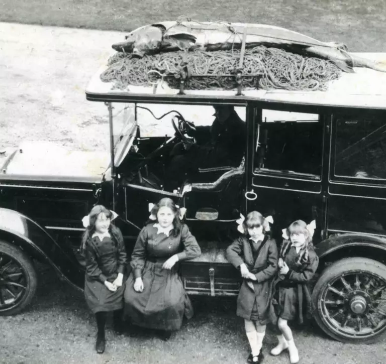
With photographs, newspaper articles, museum archives and fishing records dating as far back as 1611, the map allows users to dive into personal stories and accounts from across the UK, ranging from turn-of-the-century tales of wrangling a 3m long sturgeon in Dorset, to how the last ever fish to be accepted by the Crown almost didn’t make it from Cornwall to the Palace due to no one picking up the phone on a Saturday in 1980.
Sturgeon Conservation
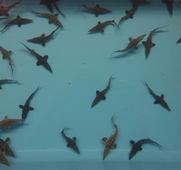
The database behind the map provides conservationists with vital information to support efforts to restore sturgeon, with the Severn and Humber catchments highlighted as historic hotspots and key areas to investigate the feasibility of conservation actions. These records have also provided new insight and evidence of how sturgeons once spawned in UK rivers, with accounts of female sturgeon spilling eggs when caught and juvenile sturgeon caught in UK waters.
Once highly prized for their meat and caviar – with the armour-like scales used for jewellery by the Victorians - sturgeons globally have been overfished. Ongoing habitat loss and barriers to migration - compounded by extreme fishing pressure in the early 20th century - led to population crashes around Europe.
With recent successful conservation reintroductions in France and Germany leading to increased sightings in UK coastal waters, the UK Sturgeon Alliance are working to make UK waters ready once again for this Critically Endangered fish.
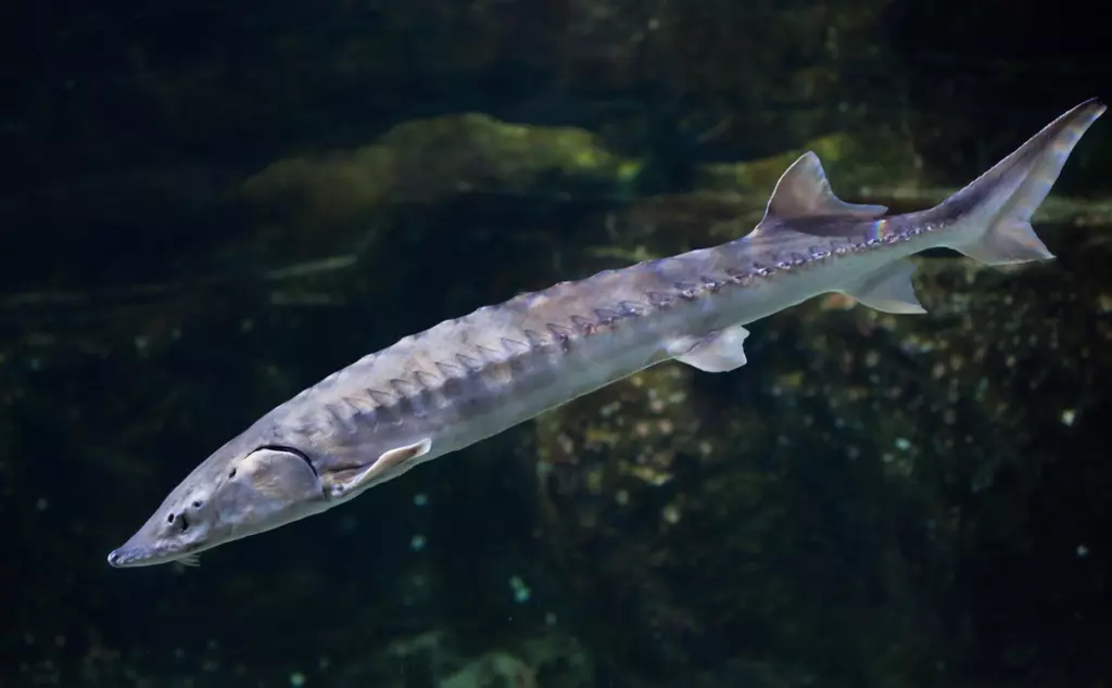
Hannah added: “Despite feeding on small fish and invertebrates living along sea and riverbeds, their impressive size means these fish have commonly been misunderstood as ‘river monsters.’ Education is a key part of our work making sure that British waters a safe home for sturgeon once more.”
The database was researched and compiled by Steve Colcough from the Institute of Fisheries Management. Steve added: “These species have been gone so long from British shores that their folklore has almost been lost to us. This new mapping tool brings that history back to life just as this iconic migrator begins to reappear in our coastal waters, thanks to the efforts of continental restoration schemes. This tool provides patterns of distribution which help guide the way forwards for sturgeon conservation in our country. Sadly, it also contains evidence of the persecution of these fish in our rivers, driven by ignorance and fear. Education is vital now as we and sturgeon move forwards together.”
As a fully migratory species that lives in rivers, estuaries and coastal habitats during their 100-year lifetime, conservation actions such as improving water quality and removing barriers to migratory routes will benefit both sturgeon and all other species that call these habitats home.
How are our conservationists working to recover sturgeon numbers?
The map – built in collaboration with conservation-focused developer agency Octophin Digital - comes as part of the team’s wider work with sturgeon, having launched the UK Sturgeon Conservation Strategy and Action Plan in 2023, a science-based guide developed by experts which meticulously outlines the action required to recover numbers of Atlantic and Critically Endangered European sturgeons in the UK.
The UK Sturgeon Alliance, a collaborative team of scientists and conservationists from ZSL, Blue Marine Foundation, Institute of Fisheries Management, Wildfowl and Wetlands Trust, Severn Rivers Trust, and Nature at Work. Their goal is to restore native sturgeon populations through conservation efforts and public education.
Any sightings of sturgeon should be reported to the Save the Sturgeon website – where it will help build an understanding of how sturgeons are currently using waters across the UK and Europe.