


Project collaborators
Professor Heather Koldewey
Lead, Bertarelli Foundation's Marine Science Programme
Dr. Robin Freeman
Lead of the Conservation AI Lab
Dr Malcolm Nicoll
Senior Research Fellow
David Curnick
Research Fellow
Jessica Savage
PhD Researcher
Rachel Jones
Marine Science Programme Manager
Emma Levy
Marine Science Programme Coordinator
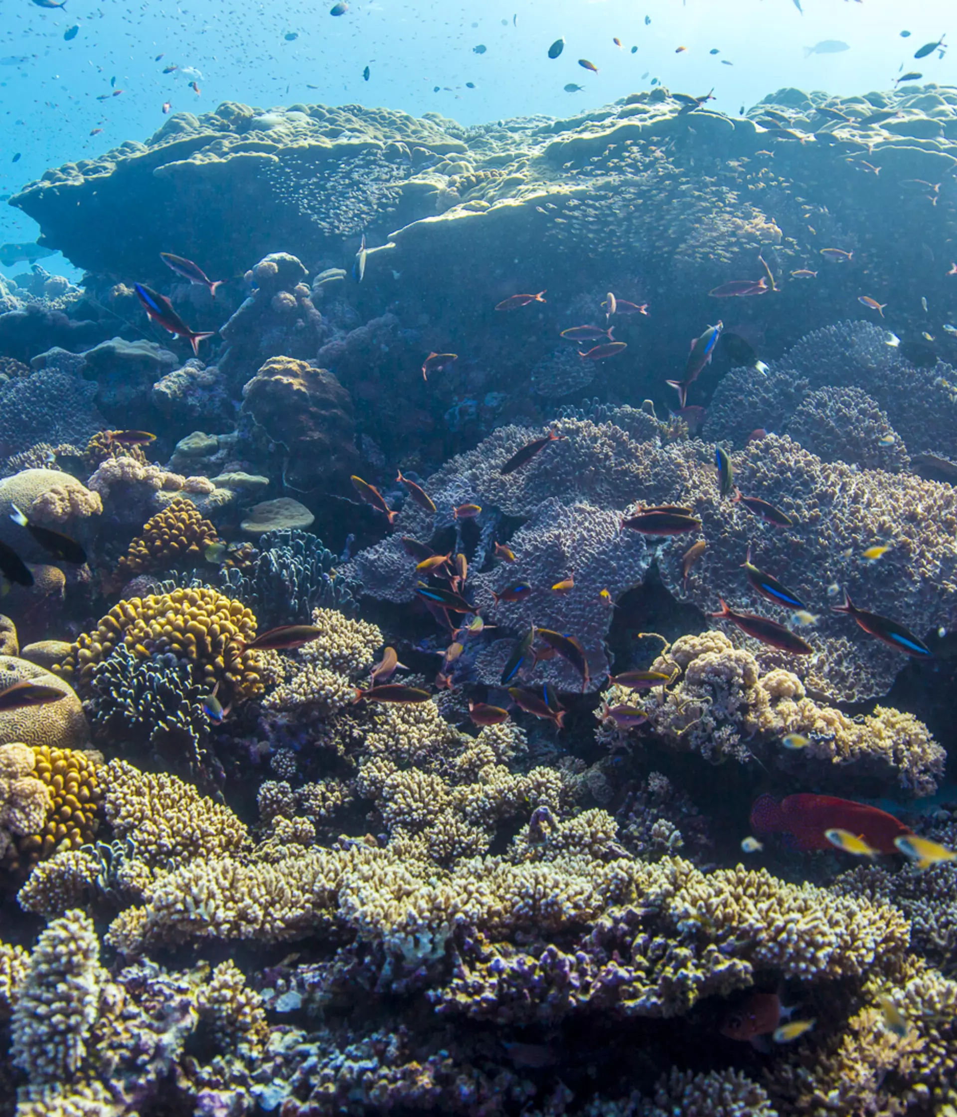
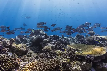
The Indian Ocean is the least scientifically known and understood, the least protected, the fastest warming, and the most exploited Ocean.
By collaborating with communities around the world, gathering data and performing vital research, we protect and restore healthy marine ecosystems so people and wildlife can thrive together.
59
remote ocean research expeditions completed since 2017
96
researchers (including 38 students) from 23 institutions from 9 countries involved in the programme
213
peer-reviewed papers have been generated between 2017-2024 from the research in the region
The Indian Ocean basin provides an important ocean observatory where scientists can investigate complex marine ecosystems across a gradient of human influence from heavily populated coastal cities to remote, no-take Marine Protected Areas.
The Bertarelli Foundation supports our Marine Science programme, which is managed by ZSL. We work with universities and NGOs across the Indian Ocean region, and research partners in Europe, North America and Australia, to increase scientific knowledge, develop research capacity and develop and transfer marine technology. The programme funds and is proactively recruiting early-career scientists and students from within the Indian Ocean region.

What is the impact?
Examples of the impact of our projects include:
- Our cutting-edge research has generated 213 peer-reviewed papers from 2017-2024. Our papers are open access and our open-access data helps to inform improved management outcomes across the region.
- Our focus on capacity building has trained 23 postgraduate students since 2017, with a current focus on students from the Indian Ocean region.
- Our research has demonstrated the link between rat-free islands with intact native vegetation, healthy seabird populations and the resilience that confers on adjacent coral reefs through nutrient flow. This body of science has informed and motivated plans for re-wilding tropical islands, as a vital conservation action to restore biodiversity and build resilience for vulnerable ecosystems in a rapidly changing climate.
Our 2024 Annual Impact Report is available to read here.

ZSL & the Bertarelli Foundation – The Marine Science Programme
Since 2017, ZSL has worked with the Bertarelli Foundation to deliver the Marine Science programme. The programme is advancing our understanding of large marine protected areas (MPAs) so they can be better managed. The primary focus of this research is the Indian Ocean, with highly collaborative and interdisciplinary projects led by some of the world’s leading marine scientists pushing the boundaries of their fields.
We are exploring approaches that improve communication of marine science to different audiences, increasing regional opportunities and access to marine science. This currently includes the Webby Award winning podcast series ‘Ocean Matters’, webinars, policy events and a regional training course for environmental journalists from the Indian Ocean region.
The programme is an official action of the UN Decade of Ocean Science for Sustainable Development.

Operations & Development
The team at ZSL manages the Marine Science programme, coordinating 96 scientists across 23 institutions and 9 countries globally. We provide communications and operational support for the projects through our team of four in Conservation and Policy. ZSL also has scientists working on research projects across the Marine Science programme.
Partners

Project information
ZSL People Involved
- Prof. Heather Koldewey - Programme Lead, Bertarelli Foundation's Marine Science Programme
- Rachel Jones - Programme Manager, Bertarelli Foundation's Marine Science Programme
- Emma Levy - Programme Coordinator, Bertarelli Foundation's Marine Science Programme
- Lasuni Chathurima (MPhil student)
- Dr. Claire Collins - Human Dimensions of Illegal, Unregulated and Unreported Fishing Project
- Dr. David Curnick
- Anthony Dancer
- Dr. Robin Freeman - Seabird Connectivity Project
- Dr. Catherine Head
- Damaris Landers (PhD student)
- Dr. Malcolm Nicoll - Seabird Connectivity Project
- Dr. Jessica Savage
Funders
The Marine Science Programme is kindly supported by the Bertarelli Foundation. Additional funding has been provided by the Darwin Plus and Darwin Local funding from DEFRA and FCDO.
People and nature can thrive together. Join our growing movement of conservationists simply by being in the know. Register now for updates on our science-led conservation work, in over 80 countries worldwide.